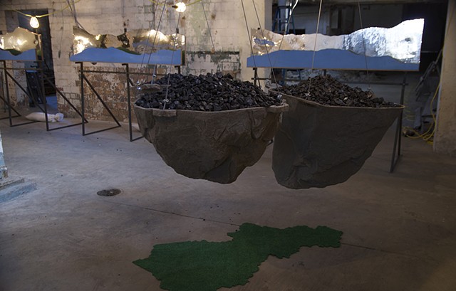
Situated in an old machine room of the Pepper Distillery complex, this sculptural installation explored the complex history of coal mining in Kentucky, specifically making connections between the region of Perry County in Eastern Kentucky and Lexington. Set against the backdrop of the former industrial space, the sculpture literally provided viewers with an opportunity to reflect on their personal consumption of coal. The silhouettes of mountaintops and ridgelines were created with mirrored mylar so that viewers could see distorted images of themselves in the landscape. These structures appeared to be small-scale billboards. The ridgelines were derived from virtual mapping of a driving route along Kentucky state highways 402 and 15 from Lexington to Hazard using Google Earth views. The entire installation is intended to question our human relationships with the natural world, and to highlight the impact of our energy consumption on the regional landscape. It is also intended as a catalyst for dialogue between urban and rural, mountain cultures and the connections of coal between distinctly different communities.
